The Most Influential
People in History

William Clark and Meriwether Lewis
1770 – 1838 and 1774 – 1809
American Explorers
Exploration Ranking 12th of 26

150th anniversary of Lewis and Clark's expedition. U.S. stamp, 1954.
Meriwether Lewis and William Clark’s expedition was the most important in the history of exploration of North America. Lewis and Clark’s diaries of their overland trip between 1804 and 1806 helped dispel ignorance about the Louisiana Territory and did much to open the way for westward settlement of the United States. “…the journals of Lewis and Clark provided the introduction to and serve as the model for all subsequent writing on the American West.”(1)
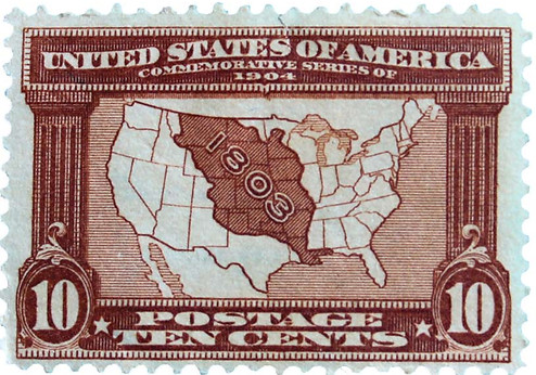
U.S. postage stamp commemorating the 100th anniversary of the Louisiana Purchase, 1904.
Preparing for the Expedition
For at least twenty years before he became President of the United States, Thomas Jefferson thought and dreamed of an overland expedition to the Pacific. In Great Britain’s formal recognition of the United States in 1784, the new nation’s western boundary was the Mississippi River. Three nations—France, Britain and Spain—were in deadly rivalry for the immense unsettled territory beyond the great river. Jefferson foresaw that any valid American claim to the vast area must be supported by discovery and exploration.
The Lewis and Clark expedition was organized and executed with much secrecy since the area they would traverse was controlled by Spain and any American explorers would be unwelcome. In the late summer or early fall of 1802, President Thomas Jefferson informed Captain Lewis, his personal secretary and fellow Virginian, that he would command an expedition to the Pacific Ocean. In preparation for his formidable adventure, Lewis spent several months in Philadelphia and Lancaster, buying scientific instruments and learning how to take latitude and longitude, to use astronomical instruments, and to make maps. He obtained medicine from the famous Dr. Benjamin Rush of Philadelphia and rounded up equipment from the quartermaster depot.
Working at Jefferson’s home, by December of that year the President gave Lewis a college undergraduate’s introduction to the liberal arts, North American geography, botany, mineralogy, astronomy and ethnology. Jefferson’s personal library was very helpful including the most extensive collection in the world on the geography of the North American continent. In January 1803, the President received approval from Congress of $2,500 for the expedition.
Jefferson suggested that Lewis select an alternate commander, as a precaution, and Lewis nominated his best friend, William Clark, a thirty-four-year-old artillery lieutenant. The choice was ideal. Clark was an experienced mapmaker, trained as an army intelligence officer, and skillful with pen and pencil in making sketches of birds, animals, and plants. Furthermore, the personalities of the two were perfect complements—Lewis a taciturn introvert, and Clark a redheaded, convivial, friendly extrovert. It is significant that the two leaders remained warm friends throughout the expedition.
In the midst of these secret preparations, in a stroke of incredible luck, Napoleon of France agreed to sell the Louisiana Territory for $15 million to the United States. The price was twice the size of the U.S. government’s annual budget but was the equivalent of only 3 cents per acre. Many consider it the greatest land purchase in history. Now the expedition could be sent out with public fanfare and without fear of Spanish interference. The newly acquired land represented one-third of the present United States. All or most of thirteen states were added to the Union: Louisiana, Arkansas, Oklahoma, Missouri, Kansas, Colorado, Wyoming, Montana, the Dakotas, Nebraska, Iowa, and Minnesota. No white man had ever set foot on a large portion.
The explorers top goal was to find the most direct and convenient route across the continent, preferably a water route commonly referred to as the “Northwest Passage.” Leading the team were Meriwether Lewis, who was tasked to study the plants and wildlife, and William Clark, who was responsible for making maps of the region. Jefferson also ordered them to take observations of latitudes and longitudes, beginning at the mouth of the Missouri, and at all “remarkable” points, such as the mouths of tributaries, rapids, and islands. In addition, President Jefferson wanted Lewis and Clark to establish formal diplomatic ties with dozens of Indian tribes and try to woo them from British and Canadian traders into the orbit of an American-based fur trade. Finally, they were to study the tribes and to describe whatever they could – populations, trade patterns, intertribal politics, languages, clothing, dwellings, social customs, food, and whatever else seemed of interest.
Significance of the Louisiana Purchase
According to the historian Bernard DeVoto, who edited the definitive condensation of Lewis and Clark’s journals: “The Louisiana Purchase was one of the most important events in world history. It was an event of such magnitude that, as Henry Adams said, its results are beyond measurement. Not only did it double the area of the United States, not only did it add to our wealth resources of incalculable value, not only did it provide a potential that was certain to make us a great power, not only did it make equally certain that we would expand beyond the Rockies to the Pacific, and not only did it secure us against foreign victory on any scale conceivable in the nineteenth century--it also provided the centripetal, unifying force that would hold the nation firm against disruptive forces from within. Whether or not the rebellion that became the Civil War was inevitable, the Purchase had made certain that it could not succeed. And there is no aspect of our national life, no part of our social and political structure, and no subsequent event in the main course of our history that it has not affected.”(2)
The Actual Expedition
On May 21, 1804, the explorers set out from St. Louis, Missouri. It is difficult to grasp this now but Lewis and Clark’s journey was more unknown than the trip to the moon. The company included a total of forty-five people, mostly Army personnel but also York, Clark’s personal slave. (under Key References see The Saga of Lewis and Clark: Into the Uncharted West, pgs. 200-201 for brief biographies of all the expedition members). Lewis also brought his giant Newfoundland dog. The men picked were enrolled in the Army at $10 a month for privates, $15 for three sergeants, and $80 each for Lewis and Clark. Twenty-nine men were trained in the rudiments of woodcraft, nine of them recruits from Kentucky, also in the party were hunters from Virginia, farmers from Vermont, and carpenters from Pennsylvania. To guard against the dangerous Indians of the plains, the captains decided to take an extra corporal and six soldiers, all to be sent back from the Mandan Indian villages in present day North Dakota. Nine rivermen were added to help row the heavy boats upstream. The iron-framed keelboat, the largest craft that had ever attempted to navigate the Missouri, was fifty-five feet long and equipped with both sails and oars. (see stamp illustration). Some of the provisions for the journey included 3,150 pounds of cornmeal, 3,400 pounds of flour, 3,705 pounds of kegged pork, and 600 pounds of “Greese.”
The most direct route, it seemed, was to ascend the Missouri to its source and make what the best minds of the day assumed to be a short portage over a single dividing ridge to the headwaters of the Columbia River. No one knew for sure. There were no dependable maps of the Missouri beyond the Mandan villages (near present-day Bismarck, North Dakota). Everything to the West Coast was terra incognita—an immense blank space with a single, deceptively thin line of conjectural peaks running from north to south.
Using horses and canoes, they made their way up the Missouri River, against the current. Almost immediately, the expedition discovered how treacherous and dangerous the Missouri, or “Big Muddy,” could be. The second day out, it was reported, “We found that our boat was too heavily laden in the stern, in consequence of which she ran on logs three times to-day. It became necessary to throw the greatest weight on the bow of the boat, a precaution very necessary in ascending both the Missouri and Mississippi rivers, in the beds of which there lie great quantities of concealed timber.” Against the main current of the Missouri, oars and poles were useless and yet the cave-ins along the banks made it highly dangerous to approach too near the shore. The swift current frequently turned the boat around, broke the towline, and drove it on sandbars.
Nevertheless, in other respects, the journey for the first several months was idyllic. There were comfortable camps at night and the party was crossing beautiful country. The two leaders spent the evenings working by firelight on their journals, recording in meticulous detail the events and observations of each day. No expedition in history was ever more carefully documented than Lewis and Clark’s.(3) Of the incidents of each day, a conscientious journal was kept by Captain Lewis or Captain Clark, and sometimes by both. The notes were afterward revised and enlarged during periods of leisure along the route. Jefferson had ordered the journals to be kept “with great pains and accuracy and to be entered distinctly and intelligible.” Other men in the company were also encouraged to record events, observations, and impressions, and seven did so, four of whose accounts survived. None was comparable in literary quality however, to those of Lewis and Clark.
Throughout the first phase of their travels—the long haul from May 21 to October 24, 1804—the explorers passed through the almost limitless prairies. Farther up the Missouri, few trees except willow and dwarf cottonwood were found. Ash trees disappeared beyond the Platte River, a misfortune for the boatmen, who needed new poles, oars, masts, or ax helves. For hundreds of miles the Missouri flowed between high bluffs, constantly undermining them. Especially in flood period causing huge trees and tracts of land to collapse into the river and to be carried downstream. Gradually the prairies gave way to the great plains. An estimated 60 million bison roamed the plains when Lewis and Clark encountered them. The bison is North America’s largest mammal with males weighing up to 2,000 pounds and standing 6 feet tall. They are extremely agile, able to jump high fences, run up to 40 miles per hour, and are strong swimmers. From Lewis’ journal on September 17th, 1804: “this senery already rich pleasing and beautiful was still farther heightened by immence herds of Buffaloe, deer Elk and Antelopes which we saw in every direction fedding on the hills and plains. I do not think I exaggerate when I estimate the number of Buffaloe which could be compre[hend]ed at one view to amount to 3000.”(4) By 1900 white sportsmen reduced their number to fewer than 300 in the states. Today there are about 500,000 bison on preserves and ranches in the United States.(5)
Three months after leaving St. Louis, the voyagers had covered 850 miles and were in the vicinity of what is now Sioux City in Iowa. From here on the going became harder. Sandbars caught the pirogues, one man collapsed from sunstroke, and Sergeant Charles Floyd died of a burst appendix. Amazingly, during the entire 2 ½ year expedition, Floyd was the only casualty. Insects almost drove the men insane. Mosquitoes bit them until they were “covered with blood and swellings” and horseflies, known as “greenheads,” tormented both men and horses.
Beyond the Platte, which the party reached on July 21, was Indian country. Most of the Indian tribes they encountered were friendly, pleased with the trinkets and drinks of whiskey given out to them. One of the first powwows was held with a group of Oto and Missouri Indians on August 3 at a site which Clark named Council Bluffs, now a thriving Iowa city. Greater apprehensions were felt about the Sioux, farther up the Missouri, the most warlike of the tribes, who clamed a monopoly of the river trade. Placated by presents and doubtless intimidated by the well-armed explorers, the Sioux let them pass, though not without threatening attacks on several occasions. The Arikara Indians, on the other hand, were too friendly. Their squaws were “handsomer than the Sioux” and “disposed to be amorous.” They were so “fond of caressing our men” that they invaded the camp to “persist in their civilities.” The big black man York particularly attracted them.
Winter at the Mandan Villages
By October signs of winter were coming in the high plains country. The Mandan villages, terminus of the boat trade from St. Louis, were reached on October 26 in cold and snow. The men set to work at once to construct winter quarters, building a log cabin about sixty feet square and naming it Fort Mandan, near the present site of Bismarck, North Dakota. In the five and a half months since leaving St. Louis, the party had traveled sixteen hundred miles up the Missouri. The next six months were spent waiting for the ice on the river to break up. The men were kept busy finding enough food and providing shelter warm enough to keep out the frigid winds (Clark recorded the temperature at forty degrees below zero on January 10). Game was scarce, but hunting parties brought in sufficient meat to keep the fort well supplied. The carefully fortified camp was guarded night and day, so that, despite threats from the Sioux, there was never an attack on the company.
A fortunate occurrence for the expedition while it was encamped at Fort Mandan was the appearance of Sacajawea, a Shoshone Indian, and her husband, Toussaint Charbonneau, who they met and hired as interpreters and guides. Sacajawea had been captured in her childhood from her people in the mountains by the Minnetarees, and sold as a slave to Charbonneau. Now nineteen, slender, with long braids of dark hair, Sacajawea was carrying a young child in a papoose on her back as the expedition resumed its travels. Her presence proved to be the difference between disaster and success for Lewis and Clark.
Leaving Fort Mandan
On April 7, 1805 when the expeditionary force embarked from Fort Mandan it numbered thirty-two men, plus Sacajawea and her infant son. The heavy longboat was left behind, and the party with all its baggage was towed in six small canoes and two large pirogues. From here on Lewis and Clark were plunging into unknown territory, “a country on which the foot of civilized men had never yet trodden.” In the beginning snow was in the air and the skies were overcast and cold. The voyagers passed the Little Missouri, the Yellowstone, and Musselshell Rivers. Animal life was abundant—bear, buffalo, wolves, deer, elk, antelope, beaver, and prairie hens.
The explorers were now getting into the country of the grizzly bears, Ursus horribilis, about whose ferocity the Indians had been telling them hair-raising tales, but no white man then knew much about these creatures and Lewis and Clark were skeptical. Several actual encounters with the huge beasts, from which the explorers barely escaped with their lives, soon persuaded them of the truth of the folklore. The bears were almost unkillable with the muzzle-loading rifles of the early nineteenth century, and one was capable of running a quarter of mile with a bullet in its heart.
Strangely, in spite of the immense amount of game surrounding them, the men saw no Indians. In five months of travel from Bismarck, North Dakota, to the foothills of the Rockies, the expedition did not meet a single human being, though there were occasional Indian signs. At the western edge of Montana, great smokes on the prairie began to be sighted, signals of a Shoshone band, but the Indians remained elusive. These were Sacajawea’s people, who evidently feared the invaders and remained out of sight.
Lewis and Clark knew that they must have guides to find a way across the mountains. At last, Lewis and several picked men proceeded ahead of the main party and several days later managed to make contact with the wary Indians. After much persuasion, the Shoshones were induced to return with Lewis to rejoin the rest of his company. There, by an amazing coincidence, it was discovered that the head chief of the Shoshones was Sacajawea’s brother, Cameahwait (literal translation from Lewis "One Who Never Walks").(6) Lewis bartered armaments, coats, blankets, and knives for thirty-eight horses.
After the departure of the fickle Shoshones, who shortly deserted them, the explorers wandered on through the Bitter Root Range. Snow began to block the passes, provisions ran low, and wild game vanished. Some of the horses had to be killed for meat. For over a week the expedition resembled a hospital ward for the critically ill more than it did a platoon of fighting men. Herein lies one of the great stories of American history, even though it is a tale of what did not happen rather than what did.
The Nez Percé Indians
In only a few moments of work the Nez Percé (pierced nose) could have killed the white men and taken for themselves all the expedition’s goods. Had the Indians done so, they would have come into possession of by far the largest arsenal not just west of the Rocky Mountains but west of the Mississippi River, along with priceless kettles, axes, hatchets, beads, and other trade items in quantities greater than any of them would ever see in their lifetimes.(7)
Like the Shoshones, the Nez Percé had had no contact with whites, other than some cheap trade goods that had reached them from Columbia River tribes. They had only one or two inferior rifles. They were constantly harassed by their neighbors who did have guns, especially by the Blackfeet when the Nez Percé made their annual trip over the mountains to the buffalo country.
The Nez Percé were hardly oblivious to their once-in-a-lifetime opportunity. According to their oral-history tradition, when they first met Clark and his six hunters—who had also gorged themselves on roots and fish and gotten dysentery—they considered killing them for their weapons. They were dissuaded by a woman names Watkuweis, (meaning “Returned from a Far Country”). She had been captured by Blackfeet some six or seven years earlier, taken into Canada, and sold to a white trader. She lived with him, among other traders, for several years before somehow finding her way home. The traders had treated her much better than the Blackfeet had done, so when Clark arrived she told the warriors, “These are the people who helped me. Do them no hurt.”
First Sacagawea, now Watkuweis. The expedition owed more to Indian women than either captain ever acknowledged.(8) And the United States owed more to the Nez Percé for their restraint than it ever acknowledged. When, in 1877, the army, carrying out government policy, drove Chief Joseph and the Nez Percé from their Idaho home, there were in the band old men and women who had as children been in the village when Lewis and Clark came through.
During the week Lewis was on his back, Clark moved camp to the junction of the North Fork of the Clearwater with the main stream, where there were Ponderosa pines of sufficient size to make canoes. With only a few healthy men and inadequate axes, Clark resorted to the Indian method of canoe-making. Instead of hewing out the trunks, he put them over a slow-burning fire trench and burned them out. Apparently the Nez Percé chief, Twisted Hair showed him how to do it. It took ten days to complete four large and one small canoe. Twisted Hair also promised to look after the expedition’s herd of thirty-eight horses until the Americans came back in the spring on their return journey—Clark had the horses branded with Lewis’s branding iron—and to accompany the party to serve as an intermediary with Indians downstream.
The Nez Percé guided the expedition to the Clearwater River to begin the last stage of their journey to the Pacific. They used the crude canoes they had built for the wild passage down the turbulent streams ahead. Entering the Clearwater, they paddled down to the Snake, and about the middle of October reached the mighty Columbia, which surged out of the north and turned westward. At the Short Narrows on the Columbia, the tremendous stream was compressed between rock precipices only forty-five yards apart, but the expedition shot the narrows with their canoes, to the astonishment of watching Indians.
Reaching the Pacific Ocean
By November 1805, they reached the Pacific Ocean having traveled 4,162 miles. They built a fort on the south side of the Columbia River near present day Astoria, Oregon and spent four miserable months with only twelve days out of about 120 without rain. Their main source of protein was elk as the men disliked fish which was readily available as well.
The expedition began the long trek homeward in late March 1806. The repassage of the mountains was dangerous enough, but the return trip required only one third as long as was consumed in traveling west. They now had landmarks to guide them, and Sacajawea to serve as guide. Near where Missoula, Montana now stands, the captains separated, Lewis leading a party to explore the north across the mountain to the Marias River and Clark riding south with another group to the headwaters of the Yellowstone. Lewis experienced the only serious mishaps. He and one of his men had to kill two Blackfeet Indians to prevent them stealing their horses and rifles—and then had to ride for their lives to escape the vengeful Indians. Two weeks later, Lewis was shot in the hip by a nearsighted member of his party who mistook him for an elk; for three weeks thereafter, the captain was unable to walk. The last entry in Lewis’ journal is August 12, when he was reunited with Clark.
Back in St. Louis
On September 23, 1806, they finally arrived back in St. Louis, after a journey of more than 7,456 miles and an absence of two-and-a-half years. The return journey only took six months with most of the path going downstream on the Missouri River. The exploration party was gone for so long that many thought they must have died.
But Lewis and Clark accomplished all they had set out to do. Lewis discovered an astonishing 178 new plants and 122 species and subspecies of animals previously known only to the native peoples. (see complete lists in The Saga of Lewis and Clark: Into the Uncharted West listed in the Key References). The animals Lewis discovered include the prairie dog, the pronghorn which resembles an antelope (the second fastest land animal in the world after the cheetah), the white-tailed jackrabbit, the black woodpecker (known today as Lewis’s woodpecker), the Eastern wood rat, the plains horned toad and the spruce grouse. Clark produced the first accurate maps of the northwest of the United States. Most importantly, they had discovered a way to the West which gave access to the rest of the continent and the Pacific Ocean. They had also established friendly relations with more than thirty Native American tribes and opened up new trade routes.
Footnotes
(1) Stephen E. Ambrose, Undaunted Courage: Meriwether Lewis, Thomas Jefferson, and the Opening of the American West, (New York, 1997), p. 405.
(2) Bernard DeVoto, editor, The Journals of Lewis and Clark, (New York, 1997), p. xxxii.
(3) Robert B. Downs, Books That Changed America, (New York, 1970), p. 34.
(4) Bernard DeVoto, p. 28.
(5) Animals, Photo Ark, American Bison, May 10, 2011, National Geographic Photo Ark, api.nationalgeographic.com.
(6) Ambrose, p. 286.
(7) Ambrose, p. 300.
(8) Ibid., p. 300.
Key References
1. The Journals of Lewis and Clark, edited by Bernard DeVoto, Forward by Stephen E. Ambrose, revised edition from 1997; original edition 1953.
2. Undaunted Courage: Meriwether Lewis, Thomas Jefferson, and the Opening of the American West by Stephen E. Ambrose, 1997.
3. The Saga of Lewis and Clark: Into the Uncharted West by Thomas Schmidt and Jeremy Schmidt, 1999. A beautifully illustrated oversize volume that discusses the details of the entire journey. The authors walked and paddled the entire route of the Expedition and over thirty years spent thousands of nights camped in wild places throughout the Rockies, the Northwest and the Great Plains. It also includes brief biographies of all the expedition members, a complete list with the common and scientific name and the date and place discovered of all 178 plants and 122 animals that were gathered during the expedition, and an annotated topographical map of the entire route spread over three gatefold pages.
4. Documentary on DVD - Lewis & Clark: The Journey of the Corps of Discovery, originally on VHS 1997, DVD 2004, produced by Ken Burns, 240 minutes; recreates Lewis and Clark's journey with reading from journals kept by the explorers and footage of their route.
5. Lewis and Clark: Great Journey West, DVD 2003, narrated by Jeff Bridges, 40 minutes. Recreates Lewis and Clark’s expedition across the western United States. A short DVD but lavishly produced on IMAX film with great attention to detail that gives a stirring visual sense of the difficulties faced by the expedition. Originally shown in IMAX theatres on 70 foot screens.
Click map to enlarge
